
| | | |||||||||||||||||||
|
Snowboarding,
telemarking and skiing Tuckerman ravine at Mount Washington
|
|
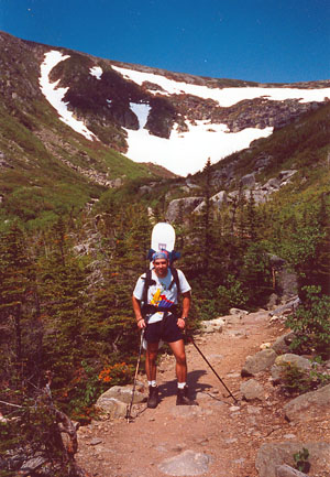
 View of Tuckerman ravine from the bottom and on July 1st below 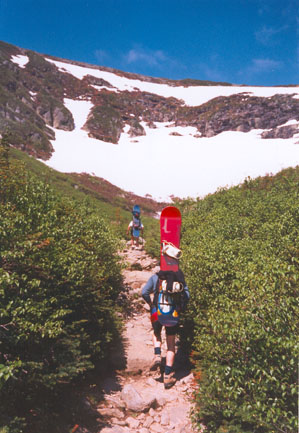
|
At the end of the month of April, the ski season is pretty much over, no more telemarking, snowboarding or skiing for another 5 or 6 months, right? WRONG!!! the season can go for another 2 months if you know where to go: Tuckerman ravine on Mount Washington, in the White Mountains of New Hampshire is the place to go for spring skiing, telemarking or snowboarding. Mount Washington is the highest mountain in eastern North America, its summit at about 2000 meters. It's not the altitude that make Tuckerman Ravine such a great and durable place to ski; it is the geography and the shape of the ravine. The geography is simple, it lies in the east of North America, it gets really cold there, allowing for lots of snowfall to accumulate, but the thing that makes tuckerman a spring skiing heaven is the orientation. I will have to say that Ihave no idea how Tuckerman is oriented, all Iknow is that it is downwind from the summit and the pervailing winds (which have a tendency to blow extremely hard most of the time, except for some weird reason during the spring telemarking and snowboarding season...). These hard winds spend the winter accumulating snow in the ravine, making for a immense base when the weather turns warm and sunny, taking therefore forever to melt. I have some friends that have skied on some good years past the 4th of July. |
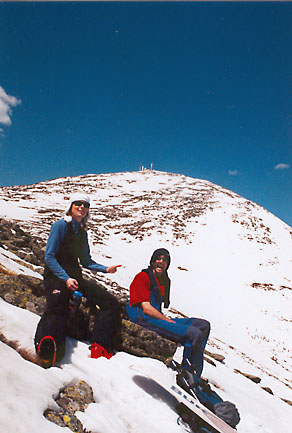
| Tuckerman is not for all skiers, there are no lifts, you will need to camp or sleep in lean- to's, carry up a heavy bag up the 11/2 to 2 hour hike to the base of the ravine, and then hike up the ravine before you can ski anything down. The lack of convenience, lifts and easy access make Tuckerman the special place it is known for, a place where people meet to do some real skiing and enjoy themselves. While it is possible to ski all winter long, the best season for Mount Washington is the spring, between April and end of June (later if there is enough snow), the winters are really cold. (Picture: the summit of Mount Washington from the top of the headwall). The skiing itself is great, the ravine is in the shape of a half bowl, with skiing possible on every side, the most favorite area being the steep middle section. While it is not the longest part of the ravine, it is the steepest and the closest to the "Lunch Rocks" where everybody watches everybody else while taking a break. |
The summit of Mount Washington from the slopes above the Headwall |
|
|
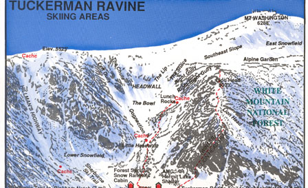
Let's start then with the middle section, it takes about 30 minutes from the "Lunch Rocks" to reach the top of the steep section, add another 15 minutes for going higher to make the descent a bit longer. The top section is at about 25 degrees, a nice warm up (if the hiking up wasn't enough) until you reach the steeper parts that reach up to 45 degress, depending on which route you take. There is even the possibility to do some pretty big airs from the top of the rock in the middle. For those not willing to ski such steepness, no need to worry, the bowl is wide and there are plenty of routes to choose from, ranging from 35 to 45 degrees, also, from right behind the Lunch Rocks climbs a more gentle couloir, that gives a good run down at about 30 degrees. For longer runs, before reaching Tuckerman ravine itself, a few couloirs (Hillman Highway), climb from the area where the rescue/ranger station is located, these will give you some good long runs and one of them is accessible from the ravine itself, by climbing the left hand side and then walking along the ridge for a while and going down Hillman highway will bring you right back to the lean-tos and the ranger station. |
| The most popular skiing is the Headwall and the couloirs alongside it next to the Lunch Rocks, between 300-400m long. A bit out of the way, Hillman Highway is the longest at about 900m and covering almost 500m of vertical drop. Of course, in the early spring, skiing down back to Pinkham notch via the Shelburne trail will take you down for about 3km of twists, turns and a vertical 600m. While it is possible to ski from the summit of Mount Washington, and it definitively makes for a long run, not many people bother due to the longer hike up and the terrain being not as challenging. |
|
|
Almost as good as the skiing itself, is the lively, festive atmosphere
that reigns: on nice sunny days, skiers, snowboarders, telemarkers and
hikers alike, all congregate at the Lunch Rocks to rest, eat lunch,
enjoy the sun and watch others go down. The more direct lines, bigger
jumps, nicest falls are all rewarded with loud cheering and applauding
from the crowd. The people on sliders or inner tubes also get large
cheers and encouragement: like the whole crowd chanting "Higher,
Higher". The ones who get the most cheering are the ones brave
enough to ski naked down the slopes of the ravine, falling is of course
rewarded with even more cheering and applause, and most probably burnt
skin. On a sunny warm spring day, the conditions are great, but it is important not to forget the avalanche and ice fall dangers, always lurking, ask the rangers and the volunter ski patrol for the safest places to go down. Also Mount Washington is known for its foul weather and a bright sunny warm day can very rapidly turn into a nasty winter nightmare if you are not prepared for it. The area of Mount Washington is not a ski area, you are responsible for your own safety, use common sense and ski, snowboard, telemark, climb within your capabilities. |
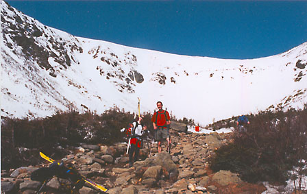
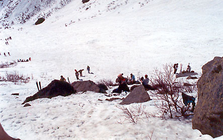 Part of the Lunch rocks |
|
Ski trails:
|