
| | | |||||||||||||||||||
|
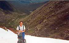
Snowboarding,
telemarking and skiing Tuckerman ravine at Mount Washington
|
|
General info - ski trails - links - other pictures
|
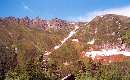
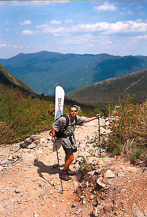
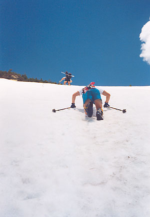
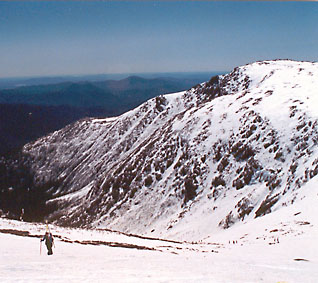
Mount Washington is located in the White Mountains national forest of New Hampshire. The whole area is big, but our concerns are the important sections for snowboarding, skiing and telemarking. The main start base is Pinkham Notch with a ranger station, shop, a cafeteria and other utilities. (showers etc...). This is the starting point of the 2 trails that will lead you to Tuckerman Ravine: the Tuckerman Ravine and Shelburne trails. Both are approximately the same in lenght and difficulties (quite easy), but if you primary goal are the Hermit Lake shelters, Tuckerman Ravine trail is the most direct route. Both trails wind up at the Forest Service ranger station from where you will be heading to the ravine itself, and if you feel like it the summit of Mount Washington. Most of the skiing, telemarking and snowboarding is done from the bowl, but a nice long return to the shelters or Pinkham Notch is Hillman Highway. From what I know, it is also the one that keeps the snow the longest (up to July on good years). |
| Lodging at Mount Washington can be tricky, the best way to organise yourself is to sleep at the Hermit Lake shelters, this will allow for a maximum of skiing, snowboarding or telemarking, but mean you will need to arrive early on to get a spot. The shelters are lean-to's and there aren't many of them. Which means that on crowded spring days, they are rapidly filled, and on cold winter nights, they are just that, cold....Once the shelters are full, you need to register for them at Pinkham Notch ranger station, it is not possible to stay on the mountain, sleeping in the wild will get you a hefty fine from the rangers, and believe me they check, even in winter.....You will know, when you register for the shelters, if they are full at Pinkham Notch, avoiding you the long hike up and back down. The leftover options are the 2 (?) campgrounds, not so far, or expensive, from Pinkham Notch or the hotels and B and B's in North Conway and the surrounding villages. Ithink there might be some dormatory style accomodations at Pinkham Notch, but not too sure. Be aware that North Conway is also an outlet shopping area and that on some long week ends it might be hard to find lodging. |
|
|
Other activities abound in and around the White Mountains National forest area: it is a place made for any kind of outdoors sports, during any season. Normal resort skiing and snowboarding is possible at Wildcat, next to Pinkham Notch and Loon and Cannon Mountains (on the other side of the Kankagamus highway, near Lincoln, a 45 minute drive from North Conway). Mount Washington is of course well known for its hiking possibilities, the national forest trails link to the Appalachian trail and have a network of multiple huts and lean-to's allowing for many multi day hiking trips. Rock climbing in the area is world renowned (Cathedral Ledge, Mount Washington itself...) and could keep you busy for a long time as there seem to be cliffs on every mountain in the region. Most are natural routes, but areas like Rumney offer bolted routes. Ice climbing is also very popular and notable, one area to mention, a bit further north in New Hampshire is Lake Willoughby. See North East Ice for the conditions of these areas. Mountain biking is also quite challenging in the area, while we have explored more the Lincoln area (Blueberry Mountain, Lafayette etc...) We also managed to get lost and break a rim in one of the trails from the Kancagamus highway. Loon mountain near Lincoln also opens its chairs in the summer and fall to downhillers. |
| General info:
Sports stores: there are many sports stores in North Conway, all of them are geared towards outdoor sports of all kinds. The ones Iremember are Eastern Mountain Sports and REI (I think). There are others, but unfortunately their names escape me. Most of them are situated on the main street of North Conway. There is a necessities shop at Pinkham Notch ranger station, selling anything you might need for a week end trip, including backpacks, poles etc... Dangers: While on a warm sunny day the area might look tame, it remains an alpine area, the skiing, snowboarding, telemarking, hiking and climbing involve avalanche, ice and rock fall, extreme weather conditions and all other types of dangers associated with mountaineering, despite the fact that Mount Washington is not a high mountain by alpine standards, its harsh weather more than compensates for the lack of altitude and brings about the same types of dangers as higher mountain ranges could. We strongly recommend bringing about mountain rescue equipment such as transciever, shovel, probe, first aid kit and helmet at the least. The latest ski casualty was just last spring (2001) when a girl slid down a couloir, couldn't self-arrest and crashed into the rocks below. Read our disclaimer. s
Ski resorts in the area:
Ice climbing:
|